Lake Hopatcong Water Level
The approved
Lake Hopatcong Water Level
Management Plan 2011 has been issued by NJ DEP. NJ DEP also provided
responses to public comment on the draft plan.
2012 Lake Hopatcong Water Level Management Report
The Lake Hopatcong Commission is not responsible for managing
the water level of Lake Hopatcong nor is it responsible for updating the Lake
Hopatcong Water Level Management Plan.
The
U.S. Geological Survey (USGS) sites below are
available to monitor the lake level, outflow into the Musconetcong River and
precipitation at the
Hopatcong State Park.
Citizen Advisory Committee
Meeting Minutes 9-13-12 & 10-10-2012
- How can I monitor the water level in Lake
Hopatcong?
- Who
controls the water level for Lake Hopatcong?
- When is the lake lowered in the fall and raised
in the spring?
- What determines if there is a "SLOW
SPEED - NO WAKE"
restriction on Lake Hopatcong?
The New Jersey Department of
Environmental Protection funds the operation and maintenance of gages
on Lake Hopatcong and at the outflow into the Musconetcong River through an agreement with the
U.S. Geological Survey (USGS).
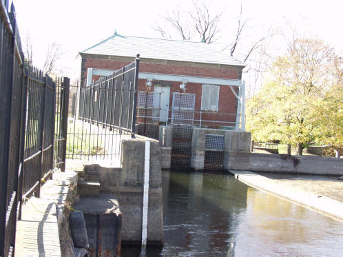
The
lake level gage
is located near the dam at the
Hopatcong State Park in Landing, New Jersey.
Mother Nature and
Hopatcong State Park personnel control the
water level in Lake Hopatcong.
Hopatcong State Park personnel
manage the lake level as outlined in the
Lake Hopatcong Water Level
Management Plan 2011 .
The goal of the
plan is to protect the environmental health and the natural and scenic resources
of Lake Hopatcong/Musconetcong River System, maximize recreational
opportunities, minimize the potential for damage to property and waterfront
structures, while maintaining the minimum flow requirements necessary to protect
downstream uses, including but not necessarily limited to: aquatic biota,
historic resources and water quality. Each year the
NJ DEP
Division of Parks and Forestry - State Park Service follows procedures to
to manage the level of Lake Hopatcong. However, the
annual precipitation does effect the raising or lowering of the lake. A
gage to monitor the precipitation is also funded by the NJ DEP through a
USGS agreement.
Both the 26 inch annual drawdown and the 60 inch (five foot) drawdown dates
will vary depending on the water level. See the
Lake Hopatcong Water Level
Management Plan 2011 for dates.
The 26 inch annual drawdown begins on or after November 12 except when the 60 inch
drawdown occurs every fifth year. Starting in late winter or early spring,
depending on when the ice breaks away from the docks, rainfall is allowed to
raise the lake level.
The 60 inch (five foot) drawdown is scheduled every five years and begins on
or after September 22. During the 60 inch drawdown from
December through February, when ice conditions permit, the lake is allowed to
rise but not higher than the 26 inches below the spillway elevation. The
next 60 inch drawdown is scheduled for September 2013.
The water level determines when there is a "SLOW
SPEED - NO WAKE" restriction on the Lake. This
"SLOW SPEED - NO WAKE"
restriction shall exist until the water level recedes below a measurement of
9.50 as
gauged from the dam at the Hopatcong State Park. "SLOW
SPEED- NO WAKE" is defined as minimal speed to make
headway in a the prevailing conditions. The New Jersey State Police enforce all
Lake
Hopatcong boating regulations.
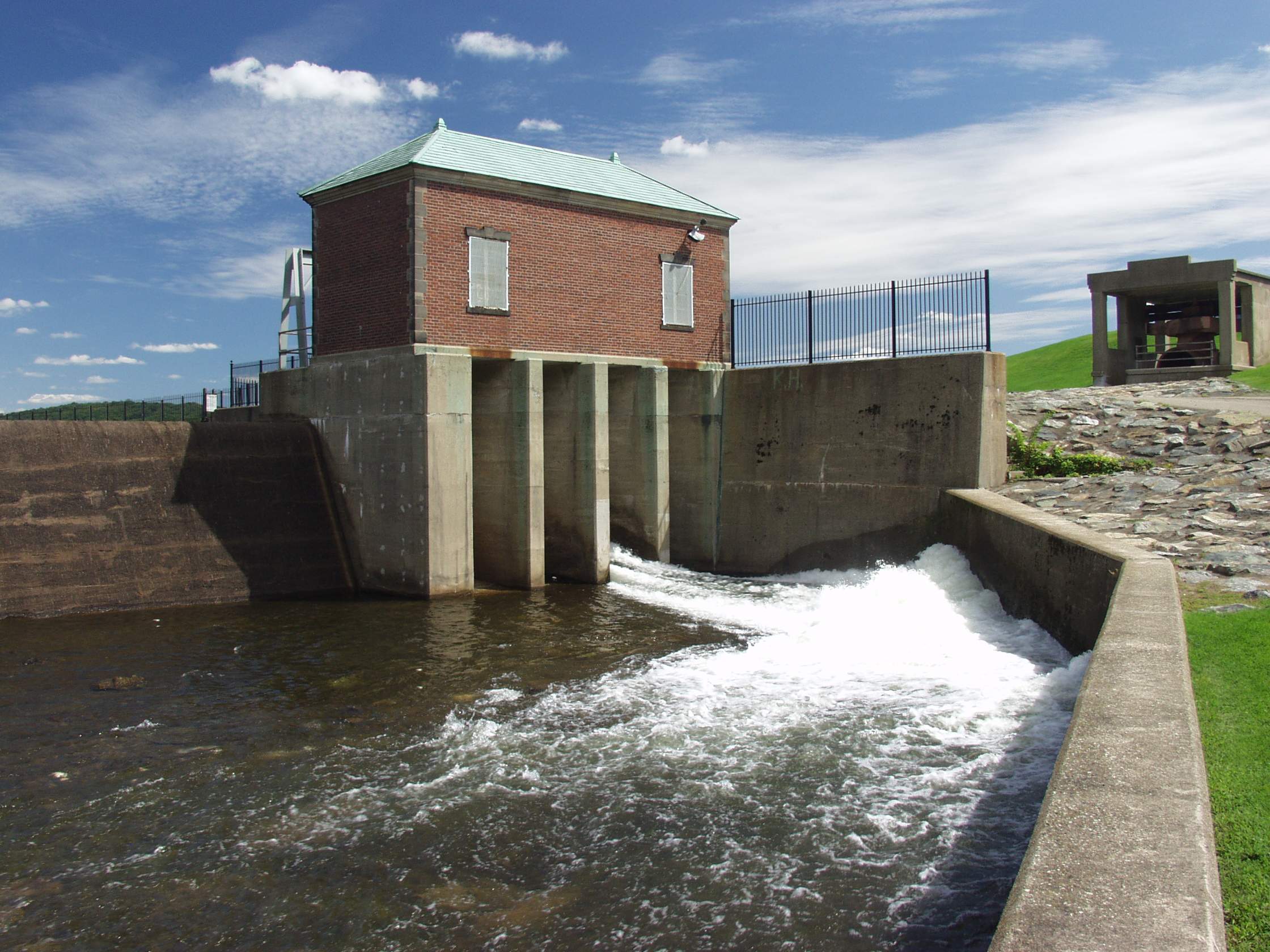 |
Crest of Dam/Spillway at Hopatcong
State Park flowing into Musconetcong River - Fall, 2003 (60 inch
drawdown) Lake level
reading of 9.00 feet on the Lake Hopatcong gage is 923.70 feet above
mean sea level or the top of the spillway. |
|
Crest of Dam/Spillway at Hopatcong
State Park from Lake Hopatcong - Fall, 2003 (60 inch drawdown) |
 |
Revised: 04/19/16.